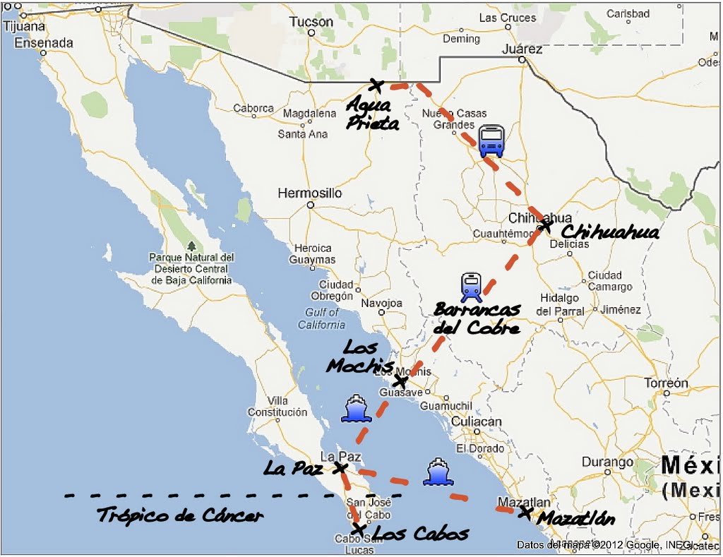
I left Victor and Reyna saying that. They hosted me for a week in Agua Prieta, at the Mexican border. An adventure, not only because I will take my first steps alone in Mexico but also because that day, for the first time since January, I left without knowing where I'll crash at night. All I knew was that this bus would send me to Chihuahua, a one-million inhabitant city, where camping is not an option. I was supposed to be hosted by Enrique, but I had had no news from him for the last two days. So I left blindly. Arrived at Chihuahua bus station, at nightfall, no cellphone, no internet, and no working public phone. Anyway, I didn't even had Enrique's number on me. Only Victor's. My only hope was that Enrique had emailed me during the day in response to mines. So taxi, city center, cyber open late (whew!) and after two and a half hours I am finally with my hosts. First experience of Mexico rich in emotion.
Two quiet days in Chihuahua. Enrique and Adria were adorable enough to let me discover their city at night when they were back from work. I also met their friends. Nothing better to improve my Spanish and discover this new country, this new culture.
 Then I took the train from Chihuahua to Los Mochis, in Sinaloa State (of the same name as the cartel...) on the Gulf of California coast. Before reaching my destination, I made a 48-hour stop in Creel, a charming village at the entrance to what the Mexicans call las Barrancas del Cobre (Copper Canyon). The story: the Spanish discovering this canyon which color was too green to be honest thought they had discovered copper mines. The history and geology proved they were wrong but the name stuck. And in Spanish, it is plural because it is not one, but a system of six different canyons.
I was looking forward to what many had introduced me as a "touristic" option to my itinerary. I was sure I was going to meet fellow travelers! Eventually it was not for this time; the hostel in Creel was empty. At the same time, I had to forget about the opportunity to share with others an guided excursion. But you will see some photos of Creel.

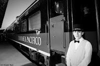
I carried on my train ride. This train is a real link. If you take a map, you will not see anything except small villages (when you see them!). And almost no roads. This is the void that only cross a railroad. El Chepe (which stands for Chihuahua Pacífico) is the only long distance mean of transport (chopper is not an alternative here). So, this train is a real small village. We find everyone: the grandmother and her bundle, the couple and their two children, young people who stupidly laugh when girls pass by, the paramilitary with his machine gun slung over his shoulder, the old men in jeans, plaid shirt, cowboy boots and cowboy hat, and women in traditional dress of the Tamahumara Indian tribe. Everyone knows everyone, or almost. I don't know anyone and for all of them I am the gringo (slightly pejorative term to designate a white US citizen). And all this little world is chatting, listening to music out loud, having lunch on the station platform when the train stops for a moment at lunchtime. Friendly atmosphere. It changed me from the undergoing tension prevailing in Chihuahua.
Again for 48 hours, I stopped at Bahuichivo (do not worry, I also have trouble with those names). My objective was to reach Urique, in the canyon of the same name. For several days I had been trying without much success to find how to get there. Through forums and blogs, I just vaguely heard of an old school bus. You know one of those famous yellow ones from North America. But the messages were more than two years old and if there was no bus, the train would have left without me and I would have been blocked two days in Bahuichivo where there is no hotel infrastructure. So when I see my old school bus parked in front of the train station, I was reassured. Eventually only half-reassured, because on the same forums, it was stated that the road had nothing to envy to a descent into hell, made of fifty-kilometer dirt roads, cliffs without guardrails, molehill, potholes and any other obstacles.
The small bus, repainted white for the occasion, was packed. Baggage was stored as we could. Some people were standing in the aisle, children on their parents' lap. Even the driver had his two children sitting on a kind of board backing their driving father's window. At first I thought about the imminence of a human sacrifice, but no, they arrived safe at destination... so did we!
The bus moved off. Everyone clung to whatever possible. A bit like in a roller coaster, the adrenaline started to rise in anticipation of imminent danger. But I was a little disappointed. The expected cliffs were only small ravines. The view was all but magical because the region is mostly forested with pines, shrubs and other vegetation dry. And the road was certainly bad, but the bus with a mother of shock-absorbers is the main responsible for us jumping on our seats at every hole on the road.
 Only two small "fears". The first one, a classic, is when the driver goes into neutral when driving downhill whereas we were supposed to go straight to a canyon! The second was when the bus suddenly broke, just after a blind turn. An ambulance was in the middle of the road, at the worst possible place. Not an accident but the whole bus almost ended up in the ambulance. Why? Because paramedics are not princesses; they need to urinate from time to time. Whether or not in a curve.
Halfway, the bus stopped. Everyone wondered why, where, how. Quite simply, it was half time, side change: the roads are separating. With some, I needed to change buses. But that was weird, as if all these regulars were discovered at each trip that they needed to be change midway. Anyway. Armed men are also there. I acted as if it was all very natural and avoided to ask myself too many questions. The only one concerned their age: those two there with their machine gun, I bet they aren't even 20 years old. The other with his M16 seems older. They were talking about the load, obviously problematic, of a pick-up.
Aboard another old white school-bus, our new driver left the village named of Mesa de Arturo. Mentally, I translated “Arthur's table”, but not time wonder more about what seemed to be linked to the Round-Table knights. Indeed, over there, after a succession of hills, it seemed that there was nothing else on the horizon. Yes, an empty space just after that very last hill. The closer we got, the more confirmed was this emptiness. And then, suddenly, everything was revealed or rather robbed: a gigantic hole. I had been warned: "You'll see, this is larger than the Grand Canyon." Obviously, having seen it, I didn't believe it at first. Now, yes! 20 kilometers (12,5 miles) remained, they were all downhill: the canyon is 1,900 meters (6,200 feet) deep. And down there, is the small village of Urique. And as on all roads on Earth, the driver is phoning when he does not argue with the nearest passenger, of course, looking steadily (it is not polite otherwise). But I didn't blame him, this one didn't go into neutral when going downhill.
On board my little white bus, the adrenaline seriously rose, inversely proportional to the slope in front of us. Although the bus most likely went into service under the presidency of Franklin D. Roosevelt, I chose to reassure by saying to myself that the United States are cherishing their children and education. And that in the country of planned obsolescence, they made an exception for school buses. Reassured about its robustness, it's me now the kid, all excited by the sight and the exceptional circumstances!
Arrived in Urique, again no one at the hostel. Not even the manager this time. I left my stuff and went to eat burritos and aluminum-foiled potato cooked in charcoal. All that emotion made me hungry. When I returned , the manager welcomed me: once again, I was alone for two days. But it didn't matter. The hostel was actually a set of small houses, a little outside the village. Rustic, minimalist, but very warm.
 About heat, the next day we had a good 45°C / 113°F in the shade. The day before I think I was to much into the descent to notice anything about weather conditions. Apart from eating mangoes that constantly fell from the trees and deliciously fresh cactus fruits, it was impossible to do anything outside. Too bad; I'd had gone for a hike. I just toured in the village. Old men playing cards on a small table set up in the shade on the sidewalk. Cows and horses roaming over the streets. And against all odds, it's game day in the small baseball stadium!
The ascent of the canyon had been substantially identical to the descent, it just looked the other way. And finally arrived at the station for the last part of the trip, I met my first fellow traveler: Bruno from Portugal. Unfortunately, it happened when I was leaving, and traveling in the opposite direction anyway. But we had a great time discussing and exchanging travel tips. The end of the train journey made us go through other (less impressive, but still) canyons.
Thanks to this all I released little of my growing fears, amplified by those who recommend the utmost caution, avoiding going out alone at night, not showing too much my camera in the street, etc. Now I must get used to ignore the dozens of pairs of eyes and looks, not discreet to say the least, who scrutinize all my actions when I'm outside.