9 March 2013

Carretera Austral (1/4)


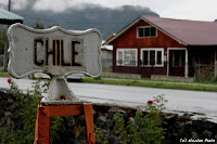
It's 7am on Thursday. The clouds are still hanging to the surrounding mountains. In a valley of the Cordillera, the small village of Futaleufu slowly wakes up. Smoke from the wood stoves is escaping from the small wooden color-washed houses. It is not cold as such; it is just very humid. Leaning over my steaming coffee, I regularly take a look out the window. The rain has not stopped since late yesterday afternoon. Clouds do not know borders; I arrived in Chile but nothing changed. Instead, with the weather coming from the Pacific ocean, I do not expect changes today or in the next days.

It's been two days since I left Bariloche. In Argentina, I hitch-hiked with uneven success, but thanks to Cesar, Carlos and Pedro I managed to reach each of the steps set (Esquel, Argentina and Futaleufu, Chile). It makes me remember when I was hitch-hiking in the Northwest United States, and specially on the wonderful and wild Pacific coast.The climate is probably helping. But the traffic here is even less dense. On the Chilean side, there is a car coming every hour and a half! Fortunately, there is a 95% chance it stops and picks me up. Hence, the average waiting time is just as good.

Click on the map to enlarge
Today's program: join the road No. 7, the famous Carretera Austral (the southern route). From Puerto Montt, the terrain becomes increasingly hostile to human settlements. About 1,600 km (1,000 mi), the Andes ends in a succession of mountains, lakes, fjords, rain forests, glaciers, until Tierra del Fuego. This area is difficult to access. At least it benefited from a "positive" outcome of General Pinochet's dictatorship: a road (sometimes asphalted) going south to Villa O'Higgins. I can not go further and will be forced to return to Argentina, El Chalten.

Between Futaleufú and the Carretera Austral I was led by Walter, happy to present the region, to name lakes and streams, to describe the colors of the water and its incredible transparency also. Not going through the whole way, I then had to walk two hours before joining Villa Santa Lucía, on the Carretera. En route, I crossed a jeep camper. Far, I don't know what intuition convinced me that they were French. The closer they drove, the more I recognized a European plate with a French flag. I stopped them and there we go: Patrice and Véronique, two smiling and enthusiastic Normans, told me about their road-trip throughout South America for two or three years. Having already spent six months doing what I intend to do on foot in one and a half months, I understand they have planned much longer!

Arriving at Villa Santa Lucía, on the Carretera, I thought and hoped there will be more traffic. No. I had to wait an hour, still in the rain, before Lucas stops. As drivers decide to stop or not, when you hitch-hike, you also have a second and a half to decide whether or not to get on board. Twice in the US, I went saying to myself with uncertainty "let's go, it should work!". Lucas had an strong accent that I could only from time to time understand and a strange behavior. Anyway, the incessant rain and the prospect of arriving safely at night made me jump in. He begun by sharing his sandwich with me. NIce. But then he also shared the bottle of Vermouth (Martini kind of)! Here I begun to understand why I couldn't understand everything. With alcohol, articulation was not his best asset anymore. Once driving his van, Lucas was dreaming himself as Sebastien Loeb [the nine-time French rally world champion]. After two days hitch-hiking in the rain and wind, I tried not to see that very nearly bumped into a goat, a public work truck, the back of a cow and a number of potholes. Instead, I even managed to escape my attention and sleep a bit thanks to the heating of the van.

Arrived safely in La Junta, I left the next morning. Patrick and Rose dropped me in Puyuhuapi where I stayed overnight. It is a charming little village on a lake with a small "Danger Tsunami" sign... oh yeah! In fact, the Pacific reaches the bottom of the small fjord. Very remote village which horizon is blocked by clouds, it really looks like the end of the Earth. It is far and wild, but it is beautiful! It is cold and wet, but this is adventure!


6 March 2013

Nico el Patagónico

Hey! This is it, you can now call me El Patagónico (the Patagonian in English). Indeed, with a certain emotion, I arrived in Patagonia. San Carlos de Bariloche (or simply Bariloche) is my first step in the Argentinian Patagonia. Emotion and pride also, I admit, to succeed in reaching the Great South from Alaska safely, in time and (almost ...) in the budget. Finally I am there! And that's what moves me from the start: to discover Patagonia was the original idea around which I then built my Pan-American route.


Patagonia, what is it? where is it? For me, this is a wild land to explore. For geographers, this is the most southern region of the world, except Antarctica. For politicians, it is five Argentinian provinces and five Chilean regions. For some of you, it's only a clothing line. And for nature lovers, these are mountains, glaciers, lakes, trees, condors, penguins and southern summer sun that still shines enough to warm us ... but for how much longer?

I will spend a month and a half going down the 3,000 km (2,000 mi) that separate me yet from Ushuaia, crisscrossing the Argentine-Chilean border from time to time. My first step, accompanied by Aïssata and Jack (two very good friends from France), made me stop in Bariloche on the shores of Lake Nahuel Huapi. And here I fell in love almost instantaneous. I certainly rank the lake among the most beautiful ones in the world. I'll let you discover in the photos.

On-site program: a lot of hiking in the mountains, on the shores of the lake, on a day or for several days, and generally under the sun. Also my first rafting experience (you'll see in the gallery of portraits to the Photos page). Very good restaurants with beef to die for. And good Argentine wine, unsurprisingly never bad. All this bodes well for the rest of my stay in the region!


3 March 2013

Buenos Aires

To be honest, I've been stuck on writing this 100th blog-post for two weeks now. I don't have all the pictures I wanted to take for various reasons. And I don't want you to overwhelm you with all kinds of explanations in the city.

So let's do simple, just some pictures. You'll see mainly the popular neighborhood of La Boca, where Italians started to migrate, very colorful: once boats were completely painted, they were happily doing the same on their house with the left-over pots of paint. For soccer fans, Diego Maradona originally from Buenos Aires played a season in the club Boca Juniors. Finally, Buenos Aires is where we traveled directly to Bariloche, the gateway to Patagonia!

Buenos Aires will remain for me a city with very European architecture as I had not seen since the beginning of my journey. It will remain as the city where I welcomed my friends Aïssata and Jacky from France and spend a fortnight with them, and the city where I said goodbye to two of my greatest traveling buddies: Kati is heading North to Brazil where she will fly to Galway, Ireland (via New York) and Henning ends her stay in South America before returning to Cologne, Germany. It was a real pleasure to meet them (in the Costa Rican mountains for the first, in a bus to Cuenca, Ecuador for the other) and travel that much with them.


25 February 2013

Uruguay

Brief summary of the previous episodes. After hitch-hiking the north-western Argentina with Fred, I joined Henning, my German traveling friend, in Asunción. We spent a week in Paraguay, then a few days in the South of Brazil to visit the Iguazu Falls, before heading to Uruguay.

Uruguay is a geographical dwarf, sandwiched between Brazil and Argentina (nearly two-thirds of South America). Its level of wealth per capita places it between Chile and Brazil, which is not nothing (especially when trying to travel cheap!) And a nice human development index: second of the continent between Argentina and Chile.

I saw the Atlantic coast for the first time since last September in Cartagena, Colombia. It was full of vacationers coming from southern Brazil and Argentina and pseudo-hippies who don't seem bothered by the high standard of life. After a night in a tent, just behind the Uruguayan border, Henning and I landed in Valizas from southern Brazil. It was carnival week, so holiday for everyone, people from everywhere. We only stayed a short day just to say we did dip in the Atlantic.

And then we went to Montevideo, the capital of the country, on the banks of the Río de la Plata, the same vast estuary that goes along Buenos Aires, 200 km to the west. Relaxation, cooking, great time during two days, hosted by Alejandro, a CouchSurfer, and time to stroll around the city emptied of its inhabitants due to Carnival (public holidays). Montevideo, a strange name: the Spanish settlers had named the place "Monte VI De Este a Oeste" ("the sixth mount from east to west") navigating Río de la Plata from east to west. Regardless if it is true, in any case Montevideo has the distinction of being the southernmost capital city of the Americas. In the world, only Wellington, New Zealand and Canberra, Australia do better.

Henning and I ended our too short week in the charming small Uruguayan town of Colonia. We strolled in the oldest city in the country (1680): a piece of wall, a mini-lighthouse, narrow cobbled streets, charming houses and beautiful flowers. Buenos Aires is in front (well, 50 kms anyway!). We took the boat and arrived in the vast metropolis, four times more populous than the entire Uruguay. The contrast is striking. There I met with Aïssata and Jack, my friends just arrived from France who will spend two weeks discovering Argentina with me.


16 February 2013

Iguazú Falls

Well, I'll let you look at the photos of Iguazu Falls. But just before, without flooding you (oh! what a funny wordplay!!) here are some pieces of information ...

We talk about Falls, or more technically cataracts. In Spanish and Portuguese, they are called also "cataratas". And the name of Iguazú comes from the Guarani (local Amerindian language) "big water". So original!

They are beautiful, powerful and impressive waterfalls. It's a lot of water. I do not know who counted the drops, but it seems that there are 6 million liters of water drop in the falls every second.

So, it gives a beautiful collection of 275 waterfalls (90 meters for the highest), nicely spread over a front of nearly two miles. And the little man that I am, accompanied by hundreds of his peers, can move fairly move around, along or above the impressive water curtains, on the Argentinian side one day, on the Brazilian one the next day.

The falls are located on the Río Iguazú, which materializes the border between Brazil and Argentina. The orientation of the reverse J-shaped system gives technically 80% of the falls to Argentina. On both sides, national parks were created to protect this exceptional natural site and are listed as World Heritage by UNESCO since 1984 (Argentina) and 1987 (Brazil). And it is not very far either the Triple Frontier between Argentina, Paraguay and Brazil.

Finally, for those who want comparison, the Niagara Falls on the border between the United States and Canada are spread over a little more than a mile (320m on the U.S. side and 790m on the Canadian side) for 50m high are therefore less important. In contrast, Victoria Falls (between Zambia and Zimbabwe) are higher than Iguazú: about 110 meters, but only 1700 meters wide.

From Iguazú, Henning and I had planned to rally the Uruguayan coast, via the South of Brazil. We spent two days in Porto Alegre at Betsy and Enderson's. Two very friendly CouchSurfers (she is originally from the US and he is Brazilian) in this quiet town with plenty of parks. Then we reached the border on the coast. Large distances, again we failed at hitch-hiking. That said, we were happy to see again the Atlantic Ocean.


12 February 2013

Unexpected Paraguay

Readers of the first hour, I owe you a little explanation. Indeed, Paraguay was not in my list of countries to visit. Worse, I was even condescending enough to consider it as a "useless" country, where there was not much to do or see.

All I knew of Paraguay, was the name of its capital (Asunción or in its longer version: Nuestra Señora Santa María de la Asunción!) and the fact that last June the right-wing opposition had cleverly hidden into a destitution what was in fact a coup to get rid of the former bishop who was elected president four years ago. Obviously, with this level of knowledge, I only had my prejudices on which to base my opinion.

Then I recalled the advice of three cyclists from Normandy, France with whom I had exchanged email when I was in Portland (Oregon, USA) last March. My ex-colleague and friend Antoine also warmly recommended me to go see what's going on on the other side of Río Paraguay. Finally, Nina and Steve with whom I shared a 4x4 to discover South-Lipez and Salar de Uyuni (Bolivia) in December had convinced me that I was missing something if I did not add that country in my list.

Finally, it happens that two very good friends are planning to visit me in Argentina from mid-February. So, between the departure of my parents in Santiago and their arrival to Buenos Aires, I had three weeks to fill in. Thus gradually came to my mind a stay in Uruguay, then a detour by the Iguazú Falls and finally a week in Paraguay. For obvious reasons of geography, I eventually reversed the order.

So I spent a week in Paraguay, where I left Fred with whom I had hitch-hiked the northwest corner of Argentina and I met Henning my traveling companion of November and December (Peru-Bolivia). And finally, like Panama, I was captivated by the Paraguay and promised myself stop being a dumb ass who thinks he knows and can judge without knowing.

And since there was supposedly not so much to do, what have I finally got up to my program? Lots of things! I started by visiting Asuncion. This is a sweet mix of colonial architecture and decrepit buildings straight from the 1960-70 (questionable aesthetics!). It is a gentle atmosphere of tranquility despite the size of the city. It was two nights in a family pension recommended by Nina & Steve and whose manager was very sweet and as talkative as interesting. And finally, we took greedy pleasure without shame or restraint: empanadas de jamón y queso (turnovers stuffed with ham and cheese).

In Asunción, I also met Rosa, an interesting personality recommended by my friend Emilie. Rosa opened the feminist cultural centre called Serafina eight years ago. It is above all a place and an association that helps lesbians (and to a lesser extent gays and transsexuals). But it is also a structure that advocates for the rights of lesbians, whose work was recognized in December 2011 by the French Republic’s Human Rights Prize. Interesting exchange on the situation and the rights of homosexuals in Paraguay, especially when they are put into perspective with the debate in France about same-sex marriage.

With Henning, we decided then to go visit the Mennonite communities of the Paraguayan Chaco, in the great North-West of the country. Mennonites? Yes, it is a religious group from Northern Germany and the Netherlands, following the precepts of a certain Menno Simons (1496-1561). Chaco Mennonites settled there in 1930, after being expelled from Communist Russia (where religious freedom was gone). In this particularly arid and inhospitable, environment, they mainly live on cattle (dairy and beef) and a bit of agriculture (peanuts and sesame). The community is divided into three colonies of fifteen villages each. At first, about 25 families made up a village. Today, they are 18,000 living in the Paraguayan Chaco. They speak a dialect German (the Plattdeutsch) and have their own educational system, German and Spanish, enhanced by the Paraguayan State. The reason for their presence? Mennonites generally look for places where they can be both guaranteed religious freedom and at the same time enjoy a certain autonomy vis-à-vis the welcoming State. Given the isolation of the Chaco, one can easily understand that the region met their criteria. So for years, Mennonites were exempt from military service (now abolished in Paraguay), not paying taxes and obeying no administrative authority from Paraguay. How does one survive in such an environment if it is so inhospitable? You adopt first a motto: "Gemeinnutz vor Eigennutz" ("The general interest before self-interest"). And then more concretely, you create cooperative, you help each other, you are disciplined and you all have the same ideal. And obviously, it works! Again, I'm glad to have dipped a little in this world that I knew by name only. I had some prejudices: people living and dressing as in the eighteenth century, etc.. No, we do not speak of Amish. Mennonites are just white men and women who speak German in the heart of South America!

We managed to hitch-hike back to Asunción, which left us naively believe we could easily hitch-hike to explore the south of Paraguay. Nay! It is a mode of travel that is not so widespread as that. Drivers made back strange signs, like raising the thumb also (saying “thanks, I'm fine!”) when they did not lift another finger! So we ended up in a bus after waiting (too much!) at the roadside.

We visited an old Jesuit mission in Trinidad. Rather than writing too much, I lazily suggest you read the very good Wikipedia article. And finally, we ended up visiting the Itaipú dam (not to be mistaken with Iguazú Falls which are not far away). For 30 years, it was the largest dam in the world before the coming into operation of the Three Gorges Dam in China in 2009. The dam is built on the Paraná River between Paraguay and Brazil. A bilateral treaty signed in 1973 allocates half the 20 turbines to Paraguay, the other half to Brazil. But as two turbines are sufficient to meet 80% of electricity demand in Paraguay, it leases its other eight to Brazil that can thus satisfy a quarter of its electricity needs with 18 turbines. And these are not small turbines! By comparison, all the water from the Iguazú Falls (you'll see pictures soon) would have the capacity to feed only two generators!

What I liked in this country in the end? First, the fact that there are very few tourists or travelers. After that, people are very friendly and very welcoming (except for hitch-hiking). And the country is beautiful: arid and flat in the vast northern region, more hilly and green (with a very red earth) in the south. But let's be honest, the cities are pretty ugly. And last prejudice, Paraguay is not a poor country, not super rich neither, but pretty well developed. The standard of living is quite high and people seem happy to live there. I eventually understood that!


7 February 2013

Hitch-hiking in Northwestern Argentina

I left my parents in Santiago and then went to Mendoza, on the Argentinian side of the Andes. I spent two days at Isaías' before hitting the road again, accompanied by Fred, met in the south of Chile. Objective: hitch-hiking four days to reach Asunción, Paraguay, meaning 1,900 km (1,200 mi).

I hear some of you saying: "Only four days for the entire Northwestern quarter of Argentina, what a pity! "But at this pace and with this mean of transport, I crossed more paths than I could have hoped by spending three weeks there. Short but intense cultural exchanges helped me learn a lot and fast on Argentina, its history, its environment, sociology, politics, scenery, ...

Some anecdotes. First, Franco was the first to pick us up. The second who stopped turned out to be his cousin! Nice surprise for us. Then we passed Beto in his truck back and forth at different places. After four times he finally stopped, hilarious, and told us to get on. For the first time on this continent, I'm not the only hitchhiker on the road. This competition is not easy to manage; it is necessary to identify the best spots to start and be sure to be taken. Unlike North America also, truckers stop and pick up hitch-hikers. At the end, the objective was achieved, good average (two days more than 700 km).

Little quiz for those who like to play. I let you assign to each his/her profession or occupation (Fred included).
  • bread deliveryman
  • electrical Engineer
  • carrier
  • advertiser
  • fries deliveryman
  • grape seed oil producer
  • computer engineer
  • owner of a trucking company
  • PhD in Linguistics
  • cattle breeder
  • radiologist
  • civil engineer
  • Sunday strollers
  • salesman
  • wind energy engineer
  • winemaker
  • travelers
Answer is in the comments (click on "Comments" under the photos below).


1 February 2013

Chile, from Santiago to Chiloé

Chile is a bloody long country. 4,300 kilometers from the arid Atacama desert just below the Tropic of Capricorn to Patagonia, gateway to Antarctica. And only up to 200 km wide between the Pacific and the Andes, which forms the border with Argentina.

I quickly crossed the North after New Year's Eve with Kati and Falko in San Pedro de Atacama. And I "landed" in Santiago to welcome my parents who came to share 15 days on the road with me. We have not gone to Patagonia (I only go there to finish my route in Ushuaia), but we saw the country!

As I did with my friend Karine during her visit in July, I now leave this blog page to two food lovers who came savor these moments with me. You now understand my taste for cooking!

Picture-wise, the choice was also with them. And the curious ones can now go to the picture gallery if you want to see what my parents look like!
_______

If it's been a while since you last traveled, if your winter seems too long, if your children have all left home, do yourself a favor and go away. I'll tell you the recipe for a successful holiday.

Take your adventurer son, decide to join him in Chile and choose to follow him. Given the size of the country, do not be too greedy: in 15 days you cant travel more than 1,400 km (870 mi), from Valparaiso to Quellón.

Start with a pinch of Santiago, a megalopolis stretching over 2,000 km², inhabited by 6 million Chileans (1/3 of the total population). The best vantage point for exploring the city, is located on one of peaks which overlooks the city: Cerro San Cristóbal.

Add Valparaiso. It was declared a World Heritage site by UNESCO in 2003. This major port on the Pacific is full of charm, with hills invaded by the city. Covered with colorful houses, it forms an urban amphitheater around the bay. Three funiculars are connecting the top of the city.

Some 800 km South, enjoy a beautiful milfoil in the Lakes region: forests, snow-capped volcanic cones (despite the summer season in the southern hemisphere) and many lakes with some charming towns on their shores.

Let the dough rest on the island of Chiloé: 6 km from the coast of Chile, 180 km long and 50 wide, the Greater Island is full of charm that reminds us our "green Normandy", facing the sea... and 40 small islands surrounding it.

Wooden houses painted like the churches provide touches of light or color where the sea and the snow-capped mountains are never far away. Many churches testify to the passage of the Jesuits and Franciscans on the island, many of which are listed as World Heritage by UNESCO.

Quellón is the village of "World's End", south of the island where the famous Pan-American Highway (or Highway No. 5) ends, at 21,000 km from Anchorage (Alaska).

Hand crafts, there are many wooden objects, or weaving, wool ... made by women. Young grandmas doddering their granddaughters will love their dolls knit ...

For cooking, no need to turn on the oven, it is between 30 and 35°C in the shade (in January is their summer) and do not forget: passed the ecuador, look for the shadow to the South!

To accompany all, you could choose French varieties, or Pisco Sour great as an aperitif or even natural fruit juices (strawberry, raspberry, pineapple ...) at any time of the day. In terms of food, taste empanada (fried dough stuffed with vegetables or seafood, or variation at infinity). And curanto in Chiloé: seafood stew with meat, potatoes ...

Icing on the cake, are the multiple meetings. Couch-Surfing is the best way to get in contact with people locally. You are welcomed "as friends" home-stay, on the sofa or better, thanks to a site where members can contact to be received or receive, on the principle of reciprocity.

Wonderful home-stay in Santiago where Mauricio and Verónica hosted us 3 nights, sharing their family life, their culture, their habits and answering all our questions through exciting discussions. Then it was Nathalie and her daughters for a culinary evening in Puerto Montt.

For participation and exchange, Nicolas offers French cooking and always ends with the famous chocolate cake (family recipe!) which is to become elected cake of the Pan-American Highway.

A nice unexpected meeting with Christiane, Luc and Dominique, three French people still anchored in the port of Puerto Montt before returning to sea on their Alioth. Also mentioning Kati who met Nicolas for the 8th time on their trip through Latin America; Reiner and Mirjam met twice; and Marie-Christine, Adrian and Caroline and their family who received us deliciously in Santiago.

Here it is... I do not know if you will try this recipe! Word of a greedy: we absolutely loved. A feast for the eyes, ears ... and taste buds!


23 January 2013

One year in America

January 23, 2012 - January 23, 2013. From Paris to Mendoza, Argentina, a year has already gone. Some figures about it:
  • 366 days
  • 47,745 kilometres (an average of 130 km a day)
  • 11 different means of transport (I let you guess them all)
  • 1,320 hours spent in transportation (meaning 54 full days) not including waiting time
  • 16 countries (USA, Canada, Mexico, Belize, Guatemala, Salvador, Honduras, Nicaragua, Costa Rica, Panama, Colombia, Ecuador, Peru, Bolivia, Chile and Argentina). For you info, Alaska is part of the US and the Galapagos islands belong to Ecuador. Still to come: Paraguay, South of Brazil and Uruguay.
  • 3 spoken languages: Français, English and Español.
  • 186 places where I hung my hat for a night or more (incl. 34 nights under my tent)
  • 19,525 pictures, 7,132 already erased and 2,745 published
  • 102 articles on the French version of this blog, 94 in English and 38 in Spanish
  • more than 30,000 visitors on those 3 different blogs
  • 12 change rate to deal with (Euro for my budget and then dollar, peso, quetzal, colón, cordoba, boliviano, etc.)
  • 12 kg in my backpack, 5 kg in my day pack, and I personally didn't loose weight!
  • 4 paires of sunglasses, 3 paires of flip-flops, 2 paires of hiking shoes, 2 paires of All Stars, 600 grammes of soap, 2 tubes of sun-block
One year is also a serie or records:
  • number of countries visited with the same person: 8 with Kati (from Galway, Ireland)
  • number of weeks traveling with the same person: 5 with Henning (from Cologne, Germany)
  • highest point: 6,000 m above sea level (almost 20,000 ft) at Huayna Potosí, Bolivia
  • lowest point: -3 m (-10 ft) snorkeling in the Galapagos islands
  • lowest température: -48°C (-55°F) in Alaska,USA
  • highest température: +45°C (114°F) in Tucson, Arizona, USA
  • dryest weather: 4% humidity in Lethbridge, Canada; it even seems that the Atacama desert in Northern Chile is not that dry
  • more humid weather: 100% humidity under tropical rain in Mexico City
  • longest distance covered at once: 1,310 km between San Pedro de Atacama and La Serena in Northern Chile
  • longest ride: 21 hours and 30 minutes to go from Lima to Cuzco, Peru
And my top 10 so far, from Alaska to Argentina :
  • Fairbanks (Alaska, USA)
  • Jasper National Park (Alberta, Canada)
  • Pacific coast of Oregon and North California (USA)
  • Grand Canyon (Arizona, USA)
  • Cordillera central (Colombia)
  • Galapagos islands (Ecuador)
  • Isla del Sol (Lake Titicaca, Bolivia)
  • Huayna Potosi (Bolivia)
  • South Lípez (Bolivia)
  • Chiloé archipelago (Chile)

20 January 2013

South-Lípez and Uyuni Salt Flat

Here are the pictures of my fantastic tour in Southwestern Bolivia. It's a beautiful region called Lípez, very desert, landscapes changing every ten minutes when you drive through them. I had the chance (thanks to my travel-lover grand-mother and her Christmas gift) to spend four days in those wonderful places, with Falko (a friend from Germany visiting me for Christmas and New Year), Kati (my regular fellow traveler for months now), and Steve and Nina a very friendly Australo-Norvegian couple.

Just for your information, the lama-like animals are called vicunas and are cousin with lamas. And the mix between rabbit and squirrel is a viscacha.


17 January 2013

Jesuit Missions of Chiquitos

I know, I'm super late in publishing pictures and articles. But I'm not the only one; my fellow travelers are doing the same. I've been quite busy with visits of my German friend Falko and now my parents. Here are some pictures of the former Jesuit Missions of Chiquitos. There is a very good article on Wikipedia if some of you are interested in learning some stuff while seeing pictures.


19 December 2012

Info Race

Day 330. Kilometre 38,825 (Mile 24,125). Latitude 16° 22' South.

A summary of my itinerary since Cuzco, with a bit of anticipation also.

Distance between Cuzco and Uyuni : 4.615 km (2,670 mi)

Left from Cuzco, I went on the shore of Lake Titicaca. Puno and the floating islands were my last step in Peru. I crossed the border: welcome to Bolivia! Then I spent two days on Isla del Sol (Sun island) on the Bolivian side of the Lake.

Then I made La Paz a base camp for my climb of Huayna Potosi and my hike in the Cordillera Apolobamba. Sucre, the “white city” and capital of the country, was the next step. Then I hit the road to reach Santa Cruz from where I am going to spend a week visiting the Jesuit Missions (I am there at present).

Back in Santa Cruz, I'll meet Falko, a German friend who comes spend the end of year in the region. We'll go to the mining city of Potosi, then Uyuni and its famous salar (salt flat), and then the wonderful region of South Lipez. After all that it will be high time to reach Chile!

16 December 2012

Cordillera de Apolobamba

Excuse my laziness and/or my lack of time, but I will just post a short report on this hike in the Cordillera de Apolobamba. If you want the full story, you can read the French version of it or copy-paste it in Google Translate.

I went for a five-day hike in the Cordillera Apolobamba, located in the North-West of La Paz, a little above Lake Titicaca. I knew this hike would be challenging since I did it alone (my German friends Henning, Paulo and Lisa left for other adventures) and with very little practical information on the trail. When you had to it days of rain and fog and snow and hail, you understand that I didn't see the magnificent landscapes I came for. But I liked it anyway. Moreover, I met a nice Czech couple and an interesting young gold minor on my way.


13 December 2012

Huayna Potosí

In Cuzco, with pictures of his ascent of Huayna Potosí, Antoine made Henning and me dream. Once Paulo and Lisa joined us in Puno, the expedition was in the pipes. After meeting Kati in La Paz, we all five knocked on the door of Altitud 6000, the agency recommended by Antoine. I don't usually make advertising, but the quality of care and professionalism of the guides are noteworthy.

We left from La Paz for three days: one day of preparation at base camp, one day ascent up to the second base camp, a third day to climb the summit and return to La Paz. You have to be ready to confront a peak at 6,088 m (19,975 ft)! Altitude-wise, it's ok, it's been several weeks since we all move around at more than 3,000 m, except Kati freshly returning from a month in the Amazonia. Physically, ascension is not the most complicated for novices like us. Finally, in terms of equipment, the agency lent us all what we needed: jacket and pants, hiking boots, gaiters, crampons, ice ax, harness, helmet, etc..

And here is the dream team: the five of us already excited and amazed by the Cordillera Real which encircles the city of La Paz, accompanied by Juancho (the mountain guide who opened this agency), William and Ismael, the other two guides, and Tofi the cook. Very good atmosphere. The ascent began in La Paz (3,600 m – 11,800 ft), then we crossed the suburb of El Alto (4,100 m – 13,450 ft) on the Altiplano. We arrived at the first base camp (indoor, don't worry!) at 4,850 m (15,900 ft).

There, a little practice was waiting for us: walking with crampons and ice axes. We even ice climbed. My only regret when I left Alaska! On the second day, a small walk to reach the second base camp (indoor as well). We acclimatised, eat well, drink mate de coca, this tea made of coca leaves to help manage the changes in elevation.

Third day, starting at 1am. The objective is clear: to be at the top for sunrise. We started in the snow and wind. Progress is slow. Kati eventually gave up in the middle. Probably not quite acclimated to the altitude. We continued still under the clouds. And suddenly, probably high enough, to 5,700 m (18,700 ft), the sky opened itself and let us see the first light of day, just above the clouds. It is so beautiful that I am really moved!


The following is less funny. I had to stop at 6,000 m (19,685 ft): the headache I'd had in the morning does not pass. It even got worse and kept me from eating and drinking. I think I never had such headache of my life, to smash it against the wall. I felt my strength gradually abandoning me and if I wanted to go down by myself, I had to keep some reserves. I stopped there and let Henning, Lisa and Paulo continue to the top, so close.

In the end, yes, I am a little disappointed not to have been able to go up there. But happy with my first mountaineering experience. And then I came down with what I was looking for: the sunrise above the clouds!

I know, I'm a little late in blogging and posting pictures. Very soon, the report of the five-day hike in the Cordillera Apolobamba from which I just returned.

11 December 2012

On the shores of Lake Titicaca

Titicaca. What a strange name! I remember giggling stupidly at the mention of this name (sounds like “pee-poop” in French) when I was younger. I confess it still makes me laugh. But where does the name? Several hypotheses, but it seems that it is a term in Aymara language that refers to the Rock of the Puma on Isla del Sol (Sun Island), the birthplace of the Inca civilisation.

A bit of geography for those who are fond of it. Lake Titicaca is located on the border between Peru and Bolivia, in this vast region called Altiplano (high plateau) at 3800 meters altitude. The highest navigable lake in the world is as big as three times the Luxembourg (or twice Rhode Island). It is a freshwater lake, half fed by rivers and half fed by the rain that falls on its surface. The lake level remains constant through the flow of the Rio Desaguadero (7.5%), but also to significant evaporation (92.5%) due to the dry climate of the region.

From Cuzco, Henning and I joined Puno, our last stop in Peru, on the shores of the lake. We met Paulo there (he left us in Lima to join Lisa in Arequipa) and Lisa. Not much to do in Puno if it is to visit the floating islands of Uros. The Uros are an indigenous Indian people originally from the lake. Chased by the Incas, they decided to flee on mini-islands they made out of reeds. These islands could be moved like floating barges. Very convenient! Later, they approached the current Puno, less prone to droughts.

These islands are quite staggering: a layer of several meters of submerged earth (which makes it floating) covered with reed, and anchored to the bottom of the shallow waters of the lake. On average, they are 500 m² and are home of five families, living in small huts made of straw. It takes 8 months to make an island, knowing that they have a life expectancy of 40 years. The coating reed is renewed every two weeks by adding new reeds, the old one being incorporated to the topsoil.

You'll be a little disappointed, but no longer Uros Indians inhabit the islands. The last representative of the people died in 1959. But the Aymara Indians are now living on the islands and run the visits. About 2,000 people live there, most men work in Puno and women run the visits and sell their handicraft products. Nowadays it looks like a attraction park, but it's still interesting to understand how the Uros lived at the time and made their islands.

We then continued our journey. Border crossing: we leave Peru. While I really enjoyed all the hiking in the Peruvian Andes, I found the Peruvians very unkind. I don't like making a generality out of a three-week experience without real contact on site. But the fact is that I was surprised to find this trait (unfriendly, unsmiling, no humour) regularly and in all the places I went. To all those who have told me that I would love Peru, tell me what I missed, please!

Bolivian first step: the Island of the Sun. It is the largest island in Lake Titicaca. Some human communities are installed (about 5,000 people), but most of the island is wild. Steppe landscape, rocky, little vegetation, it is very beautiful. We toured over two days, with a night in a tent in the centre of the island, the highest point from which we witnessed sunset and moonrise, and moonset and sunrise the next early morning. On the pictures, you will see the moonrise and sunrise the next day, in front of the lake front and the snowy Cordillera Real in the background. Nature is really beautiful!

Finally, we headed to La Paz. From the lake, we rode on the Altiplano, until we got to El Alto, on the outskirts of La Paz, perched at 4,100 m (13,500 ft) altitude. And from there, we suddenly plunged into the cauldron of La Paz, 500 vertical meters below. I met there my friend Kati (that you begin to identify now) to ascent the five of us the Huayna Potosi (6,088 m – 19,975 ft), the highest peak identifiable on pictures of the Cordillera Real.